
Mapping & Photogrammetry
Flying missions to capture multiple images we create high-resolution maps using Pix4D Mapper and DJI Terra software solutions.

Vegetation Management
Drone flybys can quickly help you establish general vegetation health, and identify stressed areas. Currently we only fly visual spectrum, but we are bringing in multispectral capability soon.

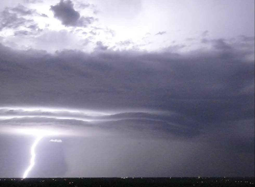
Severe Weather
This is a fun one. A storm came through the Oklahoma City metro right at sunset. We put the bear in the air to 350 feet and ran video in the direction of the storm to see what we could capture. Fork and bolt lightning was captured in a split second of the footaage, and the images extracted.


Geology and Geomorphology
Quickly and easily access difficult terrain, regardless of altitude, to image the natural world. Orthomosaic techniques can be used to accurately map and model the 3-D world not just provide 2-D represntations.


